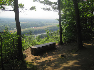
Here are a few photos of a recent hike to Mt. Sugarloaf's North and South peak.
Photos below were taken along the main trail leading to Southern Summit.

Below, a view of the Sunderland Bridge on Route 116.
A place to rest before reaching the summit.
Pictures below taken near and around the Visitors Center.
The viewing pavilion located atop Mt. Sugarloaf
The photos below are of a cave that is located off the trail leading to the northern peak:


No comments:
Post a Comment